Parks, Lakes & Beaches
Drakesbook Weir
Please note the following in relation to the Drakebrook Weir:
MARINE SAFETY - SUMMARY OF GAZETTAL NOTICES AND AREAS. February 27, 2017, METRO – PEEL, DRAKESBROOK DAM.
CLOSED WATERS – MOTORISED VESSELS
All waters of the Drakesbrook Weir are hereby closed to motor boats (excluding electric powered).
Published : 30/9/2005
Construction of the Weir
In 1931 the construction of the Waroona Weir commenced and it was completed in 1932. The Weir was constructed mostly by hand, with a small amount of machinery. Shovels, picks, wheelbarrows and a small bulldozer were used in its construction. The workers camped in tents, or if they were lucky, they owned one of the three houses close by. Most of the workers were locals. Work was hard and living conditions were just as hard.
Creatures and measurements
The Weir holds 2,290 ML. The catchment area of the Weir is 5900 hectares and has a surface area of 417 hectares.
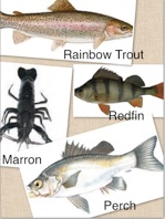
The Drakesbrook Weir is an irrigation weir, which collects the water overflow from the Waroona Dam. Farmers used the water for their livestock and crops. The Weir is a home to Rainbow Trout, Redfin, Perch and Marron; Though some of these creatures are difficult to find.
Upgraded facilities and things to do
The Weir has just had a makeover and now has upgraded toilets facilities, nature playground, swimming area, shady parking, beach sand, solar lighting, electric barbecues and shelters. The Weir is a great place to have a barbecue, picnic or just a relaxing swim. There is a pontoon to jump off and keep the children entertained. Powerboats are prohibited at the Weir. Dogs are prohibited on all grassed and adjoining beach and swimming areas, including the sand foreshore.


Noisy Scrub Bird
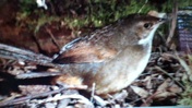 The first discovery of the Noisy Scrub bird was made in Waroona by John Gilbert and James Drummond in 1842. It was discovered in Drakes Brook Valley. The birds were rarely seen; so many people thought they were extinct. In 1961, the Noisy Scrub bird was rediscovered in Albany. The Noisy Scrub Bird is a small, solidly built bird, with a strong pointed bill, powerful legs, graduated tail and short round wings. They have a brown back and white chest with a dark cross barring extending from its head to the tip of its tail. The bird is semi-flightless and only weighs 35-55g. It eats ants, beetles and spiders. It lives in the trees near the water, scavenging for bugs and other food. The Noisy Scrub Bird was rereleased at the Drakesbrook Weir by Alcoa in the late 1990’s to increase population in the wild.
Waroona Dam (Lake Navarino)
Waroona is just over an hour’s drive south east of Perth. A caravan park is available. Please contact the Lake Navarino Holiday Park directly for bookings and general enquiries on 9733 3000 or visit their website at www.navarino.com.au
Please note lakeside camping at Navarino is currently closed.
Information on water levels in the the Waroona Dam can be found at the Water Corporation website https://www.watercorporation.com.au/water-supply/rainfall-and-dams/dam-levels/dam-levels-individual
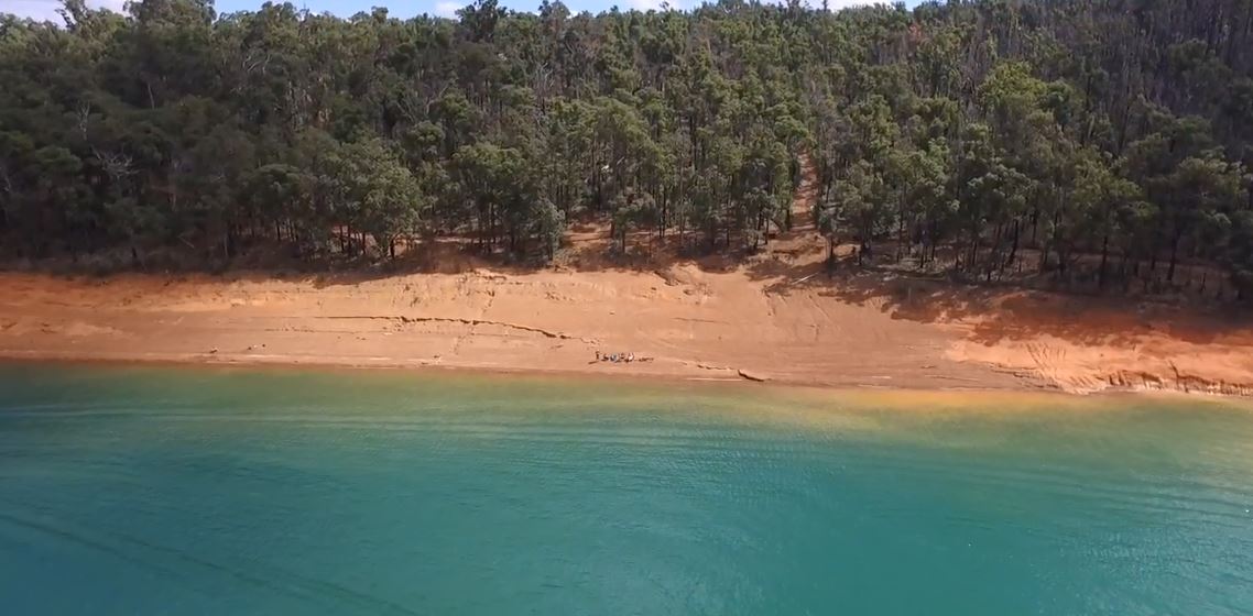
Please click the below link to view a video of Lake Navarino. The video was taken using a drone courtesy of Trent Lewis.
https://www.youtube.com/watch?v=JqmCtl4dlL8&feature=youtu.be
Background
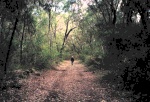
The Waroona Dam was built on the Drakes Brook with work completed in 1966. The reservoir known as Lake Navarino covers an area of 145 hectares with its primary use being irrigation. It is also used extensively for recreational activities such as water skiing and freshwater fishing. The surrounding forest provides beautiful displays of wildflowers in season. Bush walking is a popular pastime for many visitors and part of the old Bibbulmun Track is still in existence and has been reopened for public use as part of the Munda Biddi Trail.
To accommodate the building of the Waroona Dam, a construction camp was built nearby to the Dam site. After the construction was completed in 1966, the camp was leased to the Shire of Waroona and turned into a caravan park. In the mid 1980's, responsibility for the caravan park was handed to the Department of Conservation and Land Management (CALM) now known as Department of Biodiverity, Conservation and Attractions who have since leased the caravan park to a private enterprise.
In 1992, the name was changed to Lake Navarino Forest Resort, after the historical name of the main water supply for the Waroona Dam, Navarino Stream. The name of the stream has since been changed to Drakes Brook!
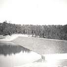
In 2002/03 the reservoir was completely drained for a major upgrade to the dam wall and a new spillway, good rains in 2004/05 refilled the reservoir to its highest level since 1999 of 98% capacity.
Over the years, the area has modernized and developed to include more self-contained accommodation, powered camping/caravan sites, new ablutions, launderette, shop/kiosk and a licensed restaurant. In 1996 the Waroona dam was completed.
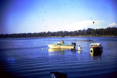
Water skiers flock to Waroona Dam just a few kilometres east of the township of Waroona. The reservoir is popular for water skiing and power boating. Most weekends, Waroona Dam is busy with power boats and water skiers gliding along the glassy water.
The fishing is also well rated – throw in a line and you’re likely to catch a trout or perch, while marron is also common.
During late winter Waroona Dam often overflows creating an amazing spectacle.
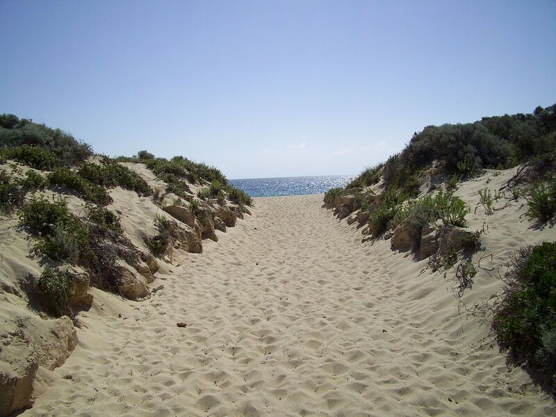
Preston Beach
The 400 lot settlement of Preston Beach is located 124 kilometres south of Perth. Bounded by the Indian Ocean, Lake Preston and the Yalgorup National Park, Preston Beach is a relaxed holiday and recreational destination for locals and tourists and home to 185 permanent residents.
Currently Preston Beach has a general store with fuel bowsers, a community centre and a 9 hole golf course. Within the town’s holiday resort, there is a bar and restaurant with indoor and alfresco dining areas that are open to the public 7 days a week. The resort also includes, for guest use only, a games area and two heated swimming pools and a tennis court. Close to the beach there is a children's playground with a lawn area and shade trees, free electric barbecues and an ablution and facilities block with universal access.
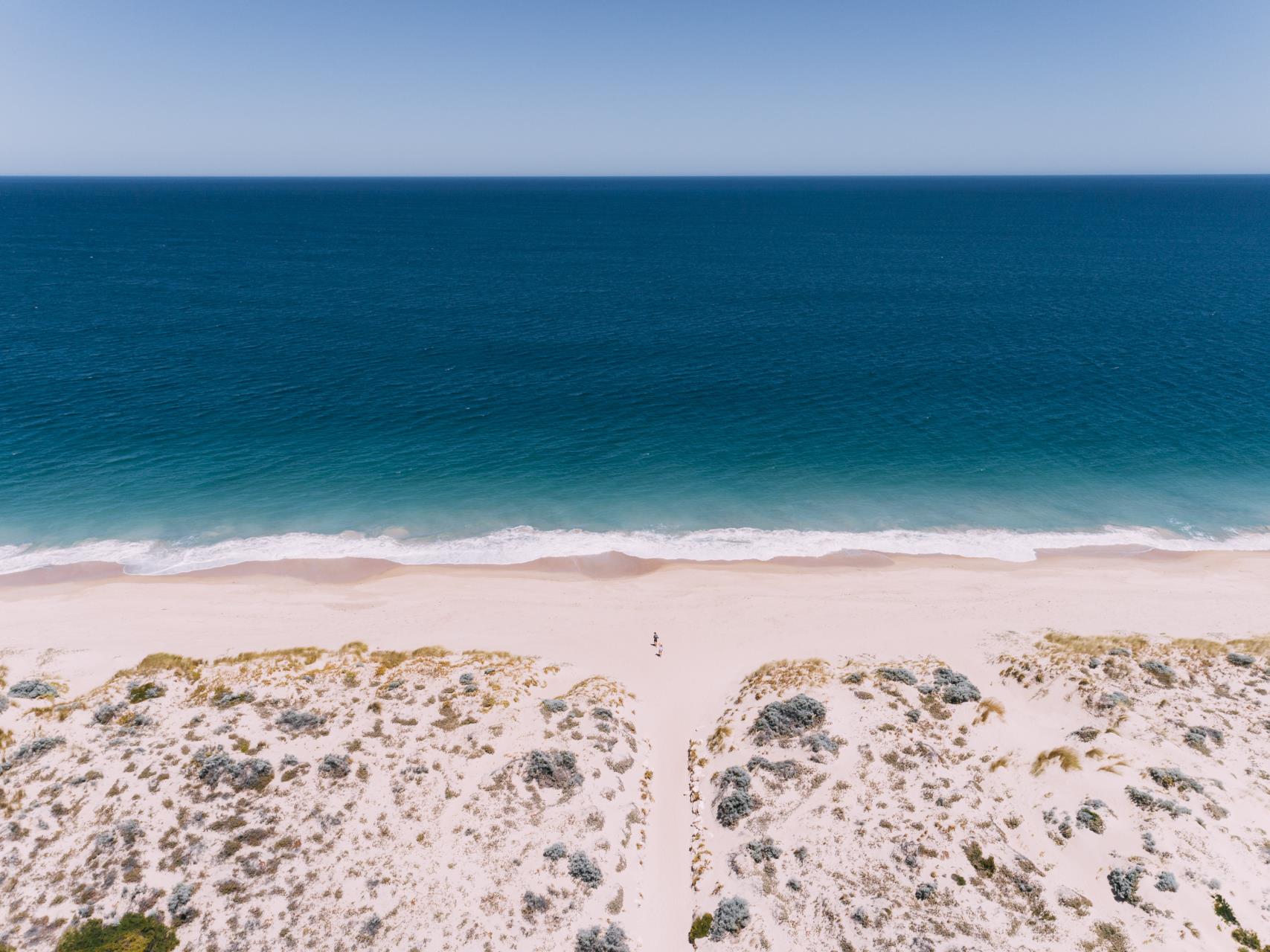
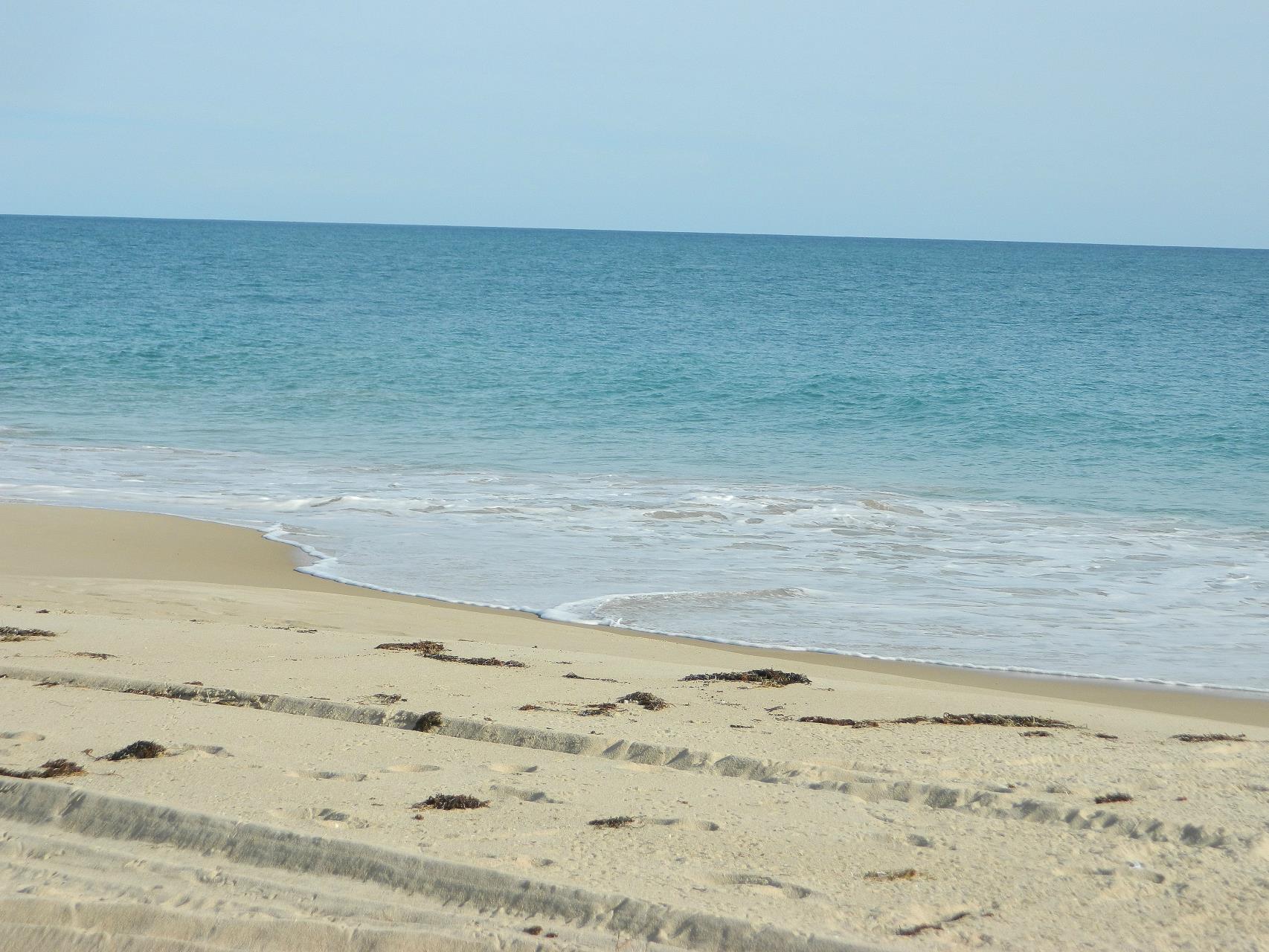
Holiday accommodation consists of a holiday resort, B&Bs, short stay holiday home rentals, and a Martin's Tank camp area with several tent sites, barbeques and toilets. Preston Beach is also one of the few places where there is 4WD access right along the beach. Preston Beach is famous for its fishing and has played host to major fishing carnivals in the past.
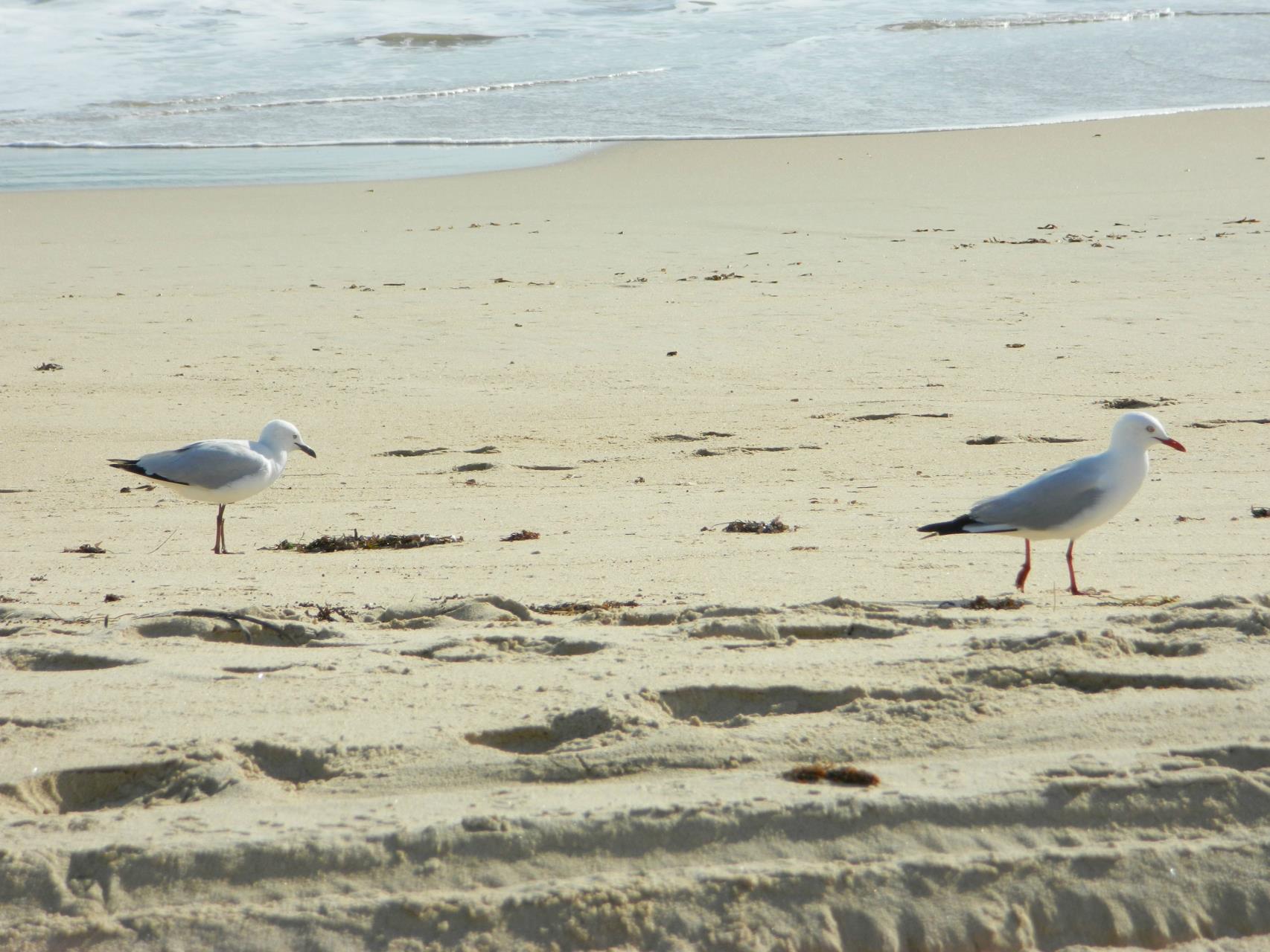
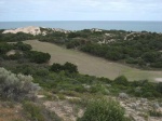
The area is also renowned for its scenic beauty. The Yalgorup National Park and the surrounding lakes attract a variety of native animals and birdlife. There are hides and viewing platforms, a boardwalk, and several walk trails for everyone to enjoy.
Bush Poles & Postie Poles
At the Information Bay you will see the carved Heritage Bush Poles crafted by members of the community.
Many homes in Preston Beach, particularly those in Hideaway Vale, have their letterboxes atop a carved "postie pole" depicting some of the area's distinctive flora and fauna.
Footprints - Preston Beach
Footprints at Preston Beach, with its native gardens and wide open spaces, provides the perfect setting for children to play and families to meet. Beautifully appointed and fully self-contained accommodation has access to a variety of facilities including the resort restaurant (cafe to a-la-carte dining), function room, swimming pool, and a full-size tennis court. Guest and boat parking available, choice of beach shack and town house style accommodation.
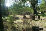
Martin's Tank Campsite
Martin's Tank campsite has barbecues, picnic tables and toilets. Booking System Only.
Martin's Tank Campsite Information
| Location |
Off Preston Beach Road North |
| Phone |
Dept of Parks & Wildlife (08) 9582 9333 |
| Website |
https://parkstay.dbca.wa.gov.au |
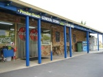
Preston Beach General Store
Enjoy the service at Preston Beach General Store. Delicious takeaways, including freshly prepared fish and chips, burgers and sandwiches. Bread and cakes are baked daily on the premises. Other lines include groceries, liquor, bait, ice and fuel.
Preston Beach General Store Information
| Location |
52 Mitchell Road, Preston Beach |
| Phone |
(08) 9739 1444 |
| Open |
Monday - Thursday 7am-6pm,
Friday & Saturday 7am-7:30pm,
Sunday 7am-6pm |
Preston Beach Golf Club
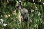
A demanding and challenging 9 hole course adjacent to Yalgorup National Park. Negotiate the undulating terrain while kangaroos assess your talent. Green fee - honour system. Players must supply their own golf clubs.
Telecentre
See Community Centre noticeboard for opening times.
Tourist Radio http://www.TouristRadio.com.au
Bunbury and Dunsborough 98.4FM
Busselton/Cowaramup (Margaret River) 96.5FM
Walking Trails
Heathlands Walk - 4.5km Grade 2 trail (approximately 90 minutes) starts at the Department of Biodiversity, Conservation and Attractions (formerly CALM) information bay. Explore the diverse vegetation from towering tuarts to the delicate flowers of the limestone ridges and enjoy sweeping views over Lake Preston to Myalup.
Lake Preston Walking Trail - Disabled friendly, 2km trail starts at the Preston Beach information bay. Meander through natural bush and groves of melaleucas to the lake where you can view the bird life from the newly erected viewing platform. Revegetation is in progress along this walk trail and fenced areas are protecting new seedlings from the kangaroos.
Lake Pollard Trail - 6km Grade 2 trail (approximately 2 hours) starts just past the entrance to Martin's Tank on Preston Beach Road North. Head through woodlands of jarrah, tuart, peppermint and bull banksia before emerging to the vistas of Lake Pollard. Black swans mass October to March and there is a bird hide next to the lake.
For more information about trails visit www.peeltrails.com.au.
Lake Clifton
Established in 1921 to support WA Portland Cement Co's lime deposit mine, Lake Clifton was a busy company town until the mine's closure in 1924. On Old Coast Road between Mandurah and Preston Beach, Lake Clifton is adjacent to the lake of the same name.
Please scroll down the page for information on " Annual Events, Things to see & do" and "Where to stay & eat" while you are visiting Lake Clifton. For more information go to www.lakeclifton.com.au.
History of Lake Clifton
 There was once a train line that ran from Waroona to Lake Clifton. (I think the bulletin was a newspaper article)
From 1919 to 1921 lime sediment was pumped from the bottom of Lake Clifton through a pipeline into settling ponds where the water evaporated and was then loaded onto trucks by hand and sent by truck to the WA Portland Cement works at Burswood.
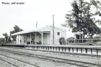
A railway line was constructed from Lake Clifton to Waroona in 1921 and the shell material was sent along this line until 1924. The train carried lime in open railway wagons from the lime kiln at Lake Clifton to Waroona and then on to the WA Portland Cement works at Burswood. Sometime between 1922 and 1923, a rotary kiln was constructed to burn the sediment at the site. This operated for just 2 weeks and was then closed down as the lime proved to be unsuitable for cement manufacture.
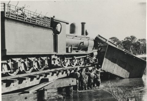
The Lake Clifton Lime Works closed in September 1923 and the railway line was partly taken up in 1924 and transported to Lake Grace for the Lake Grace to Newdegate line. There are still signs of it.
The rotary kiln itself has been removed but the brick structure that was used to support it is still standing and in very good condition.
https://drive.google.com/file/d/1chJFc50ETj7veG6cBuHBKjJ3ccZLxiiS/view
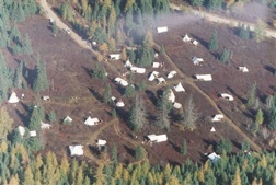
Once there was a town site at Lake Clifton and people lived in tents as houses. The train line would get them to Waroona, but as the train line was no longer in use the people from the town were unable to continue to live in such an isolated area. Food and water wasn’t able to move to and from Waroona as quickly as required.
Aerial Fertiliser spreading
Prior to 1969, on the northern side of the causeway, on the eastern side of Lake Preston, Hal Watts conducted aerial fertiliser spreading for Charlie Robertson and Merrick Tyler who owned property north of Lake Preston. Hal landed his Piper Pawnee on the eastern side of Lake Preston, on the northern side of the causeway. Bulk agricultural fertilser was carted in by Mitchells transport and unloaded in a pile ready for scooping up into the rear of the Piper Pawnee plane. The plane would then take off to the north and commence aerial spreading.
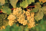
Lake Clifton Winery
Currently CLOSED due to renovations.
Relax in the rustic bar and bottle shop where you can sample and purchase the unique reds, whites and fruit wines grown in the limestone soil of the estate. Disabled access.

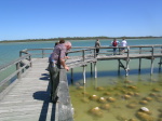
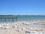
The Lakes and Birdlife
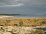
Situated within Yalgorup National Park, Lake Clifton is very salty, long and narrow and abounds with a variety of bird life. The lake provides a temporary home to hundreds of migrating birds, many of which travel great distances to breed. Birds like the Sharp Tailed Sandpiper and Red Necked Stint have come from Siberia. The Rainbow Bird migrates from the Solomon Isles and New Guinea, appearing from October to February. They have beautiful colouring, feed on bees and wasps, and burrow below the ground to nest and lay their eggs.
Recreational use of the lakes is not permitted.
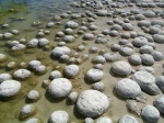
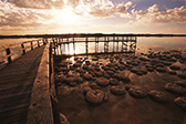
Thrombolites
Off Mount John Road an interpretive board will introduce you to the fascinating world of a rare thrombolite colony, a modern-day example of those that existed around 600 million years ago.
Thrombolites are a particular form of microbialite (rock-like structure built by micro-organisms) that have a clotted internal structure. The word thrombolite is derived from the same root as thrombosis which means clot.
Lake Clifton supports a thrombolite reef over 6km long and up to 120m wide, possibly the largest living thrombolite reef in the southern hemisphere.
A board walk leads out over the lake for easy viewing.
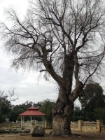
Drakesbrook Centennial Park
Drakesbrook Centennial Park is situated on South Western Hwy at the southern end of Waroona. A children’s playground, picnic seating, gas barbecues and stately trees provide a relaxed setting. Wide paths and modern toilets accommodate wheelchairs. The park is home to an interactive memorial to the old Drakesbrook School which burnt down in 2006.
Yalgorup National Park
Yalgorup (Yalgor is the aboriginal meaning for swamp or lake) was set aside as a National Park in 1968, with Lakes Pollard, Martins Tank, Yalgorup, Hayward, Newnham Clifton and Preston, added in 1971. Features of the park include the mysterious tunnels in the hillside, Lake Clifton Thombolites, home for migratory and native birds, native animals and vegetation, walk trails and picnic sites.
Quick Facts
- Lake Preston is 9 times more saline than the ocean.
- Electricity came to Preston beach in 1973.
- Communication to Preston Beach from 1969 was by two-way radio operated by the Shire of Waroona Foreman.
- Donald Campbell had planned to utilise Lake Preston to make his record-breaking water speed record if his plans to use Lake Dumbleyung weren't thwarted.
- Frank Bonney used Lake Hayward for water skiing, prior to building his own Water Ski Park south of Perth.
- At the end of summer when the water in Lake Preston receded enough, salt was raked, bagged and boxed, and used for salt licks for cattle.
References
Local History Book - Drakesbrook Days and Waroona Years
History of Preston Beach Golf Course - Waroona Historical Society Inc
Oral History – Tyler family
Photographs – Jack Caporn collection held by Tyler family